
- Topics
- Feature
- Opportunities & Events
- About
- Hindi Portal
- Data
- Topics
- Feature
- Opportunities & Events
- About
- Hindi Portal
- Data
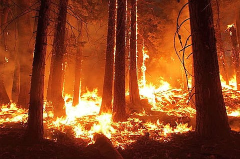
Mizoram's forest fires are predictable. (Image: Wikimedia Commons)

Every dry season, vast stretches of Mizoram’s lush hills are shrouded not by mist but by smoke. What begins as a controlled agricultural burn can quickly escalate into a wildfire, consuming forests, threatening biodiversity, damaging livelihoods, and releasing enormous quantities of carbon into the atmosphere. While forest fires are often viewed as inevitable seasonal events in North-east India, a new scientific study suggests they need not remain unpredictable.
A recent paper titled Forest Fire Susceptibility Zonation of Mizoram Using GIS: A Comparative Analysis of Bivariate Models, published in Results in Engineering (2025) by Jonmenjoy Barman, Indrajit Poddar, and Abhijit Sarkar, demonstrates that advanced geospatial modelling can identify where fires are most likely to occur with remarkable accuracy. Instead of merely documenting past fires, the researchers developed predictive maps capable of highlighting future hotspots using environmental and human-induced factors.
The study arrives at a time when forest fires are increasing globally under the combined influence of climate change, prolonged dry spells, changing land-use practices, and expanding human activities. For India, where over half of the country’s forests are exposed to occasional fires, the research provides an important blueprint for moving from reactive firefighting towards proactive risk management.
Mizoram is one of India’s most forested states, with dense tropical and subtropical forests covering much of its 21,000 square kilometres. These forests support exceptional biodiversity while regulating hydrological flows, securing critical water catchments, and providing food, fuel, and livelihoods to thousands of indigenous communities.
Ironically, the same characteristics that make the state ecologically rich also make it particularly vulnerable to fires. The state’s rugged terrain is dominated by steep slopes and narrow valleys. During the dry season, vegetation loses moisture rapidly, particularly on sun-facing slopes. Once ignition occurs, fires spread uphill with surprising speed because rising heat continuously preheats vegetation lying ahead of the fire front.
Human activity further compounds the problem. Traditional shifting cultivation, locally known as jhum, remains an integral component of agriculture across many parts of Mizoram. Although deeply embedded within local culture and often sustainable when practised under long fallow cycles, shortened cultivation intervals and increasing population pressure have increased fire risks. Burning vegetation to clear fields, accidental escapes from controlled burns, roadside ignitions, and expanding settlements all contribute to recurring fire incidents.
The researchers note that forest fires in Mizoram have already produced serious ecological and human consequences. Besides degrading forests, water sources, and wildlife habitats, major fire events have claimed lives and caused substantial economic losses. As climate change increases temperatures and alters rainfall patterns across North-east India, these risks are expected to intensify further. The challenge, therefore, is not simply extinguishing fires once they begin but identifying the landscapes where they are most likely to start and spread.
Rather than relying solely on historical fire records, the research integrates satellite imagery, climate datasets and Geographic Information Systems (GIS) to understand how multiple environmental variables interact to determine fire susceptibility.
The researchers assembled an extensive geospatial database using 453 documented forest fire locations and twelve conditioning factors that influence wildfire behaviour. These included slope, slope position, aspect, land use and land cover, vegetation health measured through the Normalised Difference Vegetation Index (NDVI), vegetation moisture using the Modified Normalised Difference Water Index (mNDWI), distance from settlements, proximity to roads, maximum temperature, precipitation, wet days and evaporation.
Satellite imagery from Landsat-8 helped estimate vegetation condition, while NASA's ASTER Digital Elevation Model supplied detailed topographic information. Climatic variables were sourced from internationally recognised gridded datasets, enabling the researchers to capture how temperature, rainfall and moisture conditions influence fire behaviour across the landscape.
Three well-established statistical modelling techniques were then compared: the Frequency Ratio (FR) model, the Evidential Belief Function (EBF) model and the Index of Entropy (IOE) model.
Although these names sound highly technical, each model essentially estimates how strongly different environmental conditions are associated with historical fire occurrence. Frequency ratio examines the probability of fire occurrence under specific environmental conditions. Index of Entropy measures the uncertainty associated with different variables and assigns relative importance accordingly. The evidential belief function goes one step further by explicitly accounting for uncertainty and incomplete information, making it particularly valuable in complex landscapes where data gaps exist.
To ensure scientific robustness, the researchers divided historical fire records into training and testing datasets. Seventy per cent of the fire inventory was used to build the models, while the remaining thirty per cent independently validated predictive performance through Receiver Operating Characteristic (ROC) analysis.
The outcome was striking. The EBF model achieved an Area Under Curve (AUC) score of 0.92 during training and 0.89 during validation, outperforming both the Frequency Ratio and Index of Entropy models. In predictive modelling, values approaching one indicate excellent accuracy, making EBF highly reliable for operational fire susceptibility mapping.
Forest fire susceptibility zones by FR (a), EBF (b), and IOE(c) methods. (Image: Authors)
One of the study's most important findings is that wildfire risk is determined not by a single factor but by the interaction of topography, vegetation, climate and human presence.
Land use and land cover emerged as the strongest predictor of fire susceptibility. Areas under shifting cultivation, croplands and bare land exhibited significantly higher fire risk because they provide abundant dry combustible material while remaining closely associated with human activity. Although forests dominate the state's landscape, vegetation itself is not inherently dangerous. Instead, degraded vegetation and disturbed landscapes become particularly vulnerable when combined with dry weather.
Distance from settlements also proved to be a major determinant. Forests located within one kilometre of villages and towns recorded considerably higher susceptibility because most ignitions originate from human activities rather than natural causes. Agricultural burning, domestic fires, land clearing and transportation corridors all increase the probability of accidental ignition.
Topography further amplifies these risks. Steep slopes accelerate uphill fire spread through enhanced convective heat transfer. Southwestern-facing slopes receive greater solar radiation, leading to drier fuels and elevated fire potential. Conversely, flatter terrain and valley bottoms generally retain moisture longer, reducing ignition probability.
Vegetation health also played a crucial role. Lower NDVI values, indicating sparse or moisture-stressed vegetation, consistently corresponded with higher fire susceptibility. Likewise, areas with lower rainfall, fewer wet days and higher evapotranspiration experienced greater wildfire risk because vegetation remained dry for extended periods.
Perhaps most significantly, the research highlights how these variables reinforce each other. A steep slope near a settlement with degraded vegetation during a dry spell becomes exponentially more dangerous than any single factor would suggest independently.
The spatial maps generated through the study reveal that the northeastern and southern parts of Mizoram contain the largest concentrations of very high fire susceptibility. National parks such as Murlen, Phawngpui and Ngengpui also fall within highly vulnerable zones, raising serious conservation concerns because these protected landscapes harbour several endemic and threatened species.
The findings demonstrate that wildfire management should prioritise landscapes rather than administrative boundaries. Fire behaviour follows ecological processes, not district limits.
Made using Gemini AI
The greatest contribution of this study lies not merely in identifying where fires are likely but in demonstrating how science can transform forest governance.
Traditionally, India's wildfire response has focused heavily on suppression after fires begin. Forest departments deploy personnel once satellite alerts detect active fires, often struggling with inaccessible terrain, inadequate equipment and delayed response times. Predictive susceptibility maps offer an opportunity to intervene much earlier.
High-risk landscapes identified through geospatial modelling should become priority zones for fuel management, creation of strategically located firebreaks, seasonal surveillance and deployment of rapid-response teams. Limited financial and human resources can then be directed towards the locations where they are most likely to prevent catastrophic fires rather than being spread thinly across entire states.
Community participation must also become the centrepiece of wildfire management. Since proximity to settlements emerged as one of the strongest predictors of fire occurrence, local communities are not simply stakeholders but essential partners in prevention. Expanding community fire brigades, strengthening awareness campaigns before the fire season and promoting safer agricultural burning techniques could substantially reduce accidental ignitions.
The study also highlights the need to modernise shifting cultivation rather than merely discourage it. Blanket restrictions rarely succeed where jhum remains culturally and economically important. Instead, governments should support controlled burning protocols, improved fire containment measures, longer fallow cycles and diversified livelihood options that reduce pressure on forest landscapes.
Technology offers another major opportunity. Integrating the EBF modelling framework with near real-time satellite observations, weather forecasts and artificial intelligence could enable dynamic fire danger forecasts that change daily according to temperature, humidity and vegetation moisture. Such systems are already operational in countries including Australia, Canada and the United States. India possesses the satellite capability through ISRO and the institutional capacity through the Forest Survey of India and state forest departments to develop similar operational platforms.
Protected areas deserve particular attention. Since several national parks fall within high-susceptibility zones, fire management plans must be incorporated into wildlife conservation strategies. Early warning systems, fuel load monitoring, ecological restoration of degraded patches and improved access routes for emergency response could significantly reduce biodiversity losses.
Finally, the research offers lessons well beyond Mizoram. Similar mountainous regions across Nagaland, Manipur, Meghalaya, Arunachal Pradesh, and parts of the eastern Himalaya share comparable terrain, vegetation, and land-use characteristics. The modelling framework demonstrated in this study is readily transferrable, providing an evidence-based approach for developing state-specific fire susceptibility maps across India’s fire-prone landscapes.
As climate change continues to lengthen fire seasons and increase weather extremes, forest fires can no longer be treated as isolated seasonal disasters. They are becoming a defining ecological challenge with implications for biodiversity conservation, carbon storage, water security, and rural livelihoods. Studies such as this show that the tools to anticipate wildfire risk already exist. The real challenge now lies in ensuring that scientific evidence informs policy before the next fire season begins, rather than becoming another report consulted only after forests have already burned.