- Topics
- Feature
- Opportunities & Events
- About
- Hindi Portal
- Data
- Topics
- Feature
- Opportunities & Events
- About
- Hindi Portal
- Data
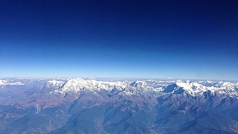
The Hindu Kush Himalayas (HKH) cover 3500 kms across eight countries namely Afghanistan, Bangladesh, Bhutan, China, India, Myanmar, Nepal and Pakistan. Commonly described as the “water towers for Asia” the HKH are the source of 10 major rivers including the mighty Ganges, Brahmaputra and the Indus that provide water, food, energy and support a range of other ecosystem services for two billion people across Asia.
However, recent analysis shows that these water towers could be in peril with the increasing threat of climate change and anthropogenic activities. And this could have a serious impact on the lives and livelihoods of millions residing in the region!
The chapter ‘Water in the Hindu Kush Himalayas’ from the ‘The Hindu Kush Himalaya Assessment’ report by ICIMOD provides an overview of the water resources in the Himalayan region, highlights the factors that could lead to a major water crisis in the region and proposes the way forward to deal with the situation.
Water in the HKH comes from varied sources. The monsoon forms the main source of water for the eastern Himalayas mainly between June and September. In contrast, rainfall in the Pamir, Hindu Kush, and Karakoram ranges in the west is caused by westerly and southwesterly winds and is evenly distributed throughout the year. In winter, the western Himalayas receive at least half of its precipitation from western disturbances.
Glaciers and snow melt also form important sources of water and also crucial components of streamflows that feed into rivers, mainly the western rivers, such as the Indus. These contribute relatively low to the eastern rivers, such as the Ganges and the Brahmaputra, where rainfall runoff contributes the largest share of stream?ow. The contribution of glacier and snow melt increases with altitude and proximity to glacier and snow reserves.
Groundwater, from springs in the mid-hills of the HKH, is another important contributor to river base ?ows. Mountain springs play an important role in generating stream?ow for non-glaciated catchments and in maintaining winter and dry-season ?ows across numerous HKH basins.
There are wide variations in per capita availability of water and contribution from the different surface and groundwater sources by country in the HKH region. The total renewable water availability in the eight countries from the HKH is 7745.5 km3. The total volume and per capita water withdrawal, contribution of different water sources to total water withdrawals and amount of water withdrawal compared to freshwater resources available for different countries vary widely in the region. For example, per capita water withdrawals vary from 1096 m3/year in Pakistan to 247 m3/year in Bangladesh. While Pakistan withdraws 74 percent of its water from renewable freshwater resources, Bhutan withdraws less than 0.5 percent annually. Groundwater accounts for 79.4 percent of water withdrawal in Bangladesh and 33 percent in India and Pakistan.
Agriculture accounts for most of the (90 percent) water withdrawal in all HKH countries and industry about 10 percent with the exception of China, where 65 percent is used for agriculture and 25 percent for industrial purposes. Mountains, mid-hills, and plains (including foothills of the Himalayas) offer three distinct agricultural systems in the HKH region that vary in terms of water resources used.
For example, agriculture in the mountains and mid-hills is rainfed, while that of the plains is irrigated. Most HKH countries still have the centuries old tradition of farmer managed hill and mountain agriculture. While mostly rainfed, these farms are also irrigated seasonally by local streams, springs, glaciers and snowmelt that are diverted through channels along the mountain slopes to the bottom of the valleys where fruits, vegetables and crops are grown.
Irrigation is used extensively in the plains and varies by region. For example, areas like the Indo-Gangetic Plains in Pakistan, India, and Bangladesh are intensely irrigated. While most of these plains have canal infrastructure, groundwater has emerged as the main source of water for irrigation. India is the largest user of agricultural groundwater with over 20 million groundwater wells pumping water, of which more than 95 percent are privately owned by smallholder farmers. Groundwater use in India is also characterised by extreme exploitation in states like Punjab, Haryana, and western Uttar Pradesh and low groundwater development in the states of West Bengal, Bihar, Orissa, and Assam.
While increasing anthropogenic activities such as urbanisation, industrialisation, tourism, land use changes, hydropower generation in the region have already strained the available water resources and raised quality concerns threatening agricultural production, sanitation and health outcomes, the situation is predicted to further worsen with climate change.
Current research shows that glaciers in the Himalayas are melting at a fast rate due to global warming. Climate change has also led to highly erratic rainfall patterns with the increase in the number of intense precipitation days and intensity of extreme precipitation. This has been feared to lead to consistent increases in the total stream?ow of the Indus, Ganges, and Brahmaputra rivers. In the Indus, this increase will come from increased glacial melt, while in the Ganges and the Brahmaputra, it is expected to come mainly from precipitation. This could lead to an increase in water-related hazards such as floods in the area.
While glacier melting would increase river flows in the initial stages, the fast melting of glaciers will also mean that most of the rivers will have lower flows in the future, especially the Indus and central Asian rivers, spelling doom for the region and having major implications for irrigation and agriculture, hydropower and ecosystem-based services in the region. Decline in pre-monsoon river flows have already found to affect the cropping patterns in the region.
The authors argue that adequate water availability alone is not enough to ensure water security in the region. Good water governance that is politically and culturally tailored to the local, national, and regional contexts is the need of the hour.
Water governance in the HKH continues to be a challenge due to various reasons like an ecologically fragile landscape, dispersed settlements, water management regimes that often lack synergy and coordination, unequal power dynamics, centralised decision making and inadequate opportunities for local communities to in?uence their water-security decisions despite the presence of local institutions.
More attention needs to be paid to the local HKH-speci?c conditions and contexts and emphasis needs to be placed on participatory and cooperative decision making (formal, informal, and hybrid), evidence-based policies, transparent programme implementation and transboundary and regional cooperation to help conserve the water resources in the region.
A copy of the paper can be accessed here