- Topics
- Feature
- Opportunities & Events
- About
- Hindi Portal
- Data
- Topics
- Feature
- Opportunities & Events
- About
- Hindi Portal
- Data
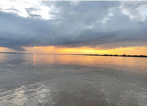
The Mahanadi at Chhattisgarh.
VishuN via Wikimedia Commons

India’s great river deltas have long been seen as landscapes of abundance. A river delta is a triangular lobular landform created when rivers empty their water and sediment into another body of water, such as an ocean, lake, or an estuary. A river slows down as it reaches its end and this causes the sediment and solid material that it carries through its currents to fall or accumulate at the base of the river that gradually builds up into new land. A mature deltaic lobe includes a distributary network—a series of smaller, shallower channels, called distributaries, that branch off from the mainstream of the river.
Built slowly over centuries by rivers carrying sediment from mountains to the sea, these regions support fertile agriculture, dense settlements, fisheries, ports, and unique ecosystems. From the Ganga Brahmaputra plains to the Mahanadi and Godavari coasts, deltas have sustained livelihoods and shaped regional economies for generations.
A new global scientific study now reveals a troubling shift beneath these productive landscapes. More than half of the world’s major river deltas are sinking, and several of India’s largest deltas are subsiding at rates faster than global sea level rise. The driver is not only climate change or coastal erosion, but human activity itself, particularly unsustainable groundwater extraction.
Published in the journal, Nature, the study uses satellite based observations to show that excessive withdrawal of groundwater, combined with reduced sediment flows and rapid urban expansion, is causing land surfaces across delta regions to slowly collapse. As underground water reserves are depleted, sediments compact and land elevation declines, making already vulnerable coastal regions more exposed to flooding, salinity intrusion, and permanent land loss.
The deltas of the Ganga Brahmaputra, Brahmani, Mahanadi, Godavari, and Cauvery rivers are sinking, placing millions of people at increasing risk of flooding. The study identifies uncontrolled groundwater extraction as a major driver of this land subsidence.
For India, where large populations live and farm across low lying delta regions, this finding changes how coastal risk must be understood. The danger is not only from rising seas. In several regions, the land is sinking faster than sea levels are rising.
The concern now goes beyond future climate impacts. Current patterns of groundwater use are steadily weakening delta landscapes, raising an urgent question about how long these fragile systems can continue to support lives and livelihoods.
Ganges river delta as seen from space.
NASA via Wikimedia Commons
Like most wetlands, deltas are incredibly diverse and ecologically important ecosystems. These dynamic landforms serve important socioeconomic, ecological and energy-related functions.
They support agriculture:
Deltas have a rich accumulation of silt, that serves as fertile land for agriculture. The world's largest delta is the Ganges–Brahmaputra delta in India and Bangladesh, which empties into the Bay of Bengal. Fish, other seafood, and crops such as rice and tea are the leading agricultural products of the delta.
They harbour incredible biodiversity
Deltas are also important wetland habitats and a large number of rare plants grow in the delta regions such as lilies, hibiscus, herbs such as wort, which are used in traditional medicines. Many animals are found in the shallow, shifting waters of a delta. For example, a large variety of fish, crustaceans such as oysters, birds, insects, and even apex predators such as tigers and bears are a part of river deltas.
Human settlements thrive near deltas
Many major cities and civilizations developed around deltas that serve as important places for trade and commerce with their ports and transportation networks being vital to national, regional and global economies.
Deltas offer natural protection from disasters
Deltas absorb runoff from floods (from rivers) and storms (from lakes or oceans). They also filter water as it slowly makes its way through the distributary network helping reduce the impact of pollution flowing from upstream.
While deltas occupy only 1% of land area, they are among the most vital landforms on Earth. Globally, deltas host an estimated 350–500 million people including 10 of the 34 megacities of the world. Deltas are vulnerable to rising sea levels, storms, land subsidence, shifting temperatures and rainfall patterns that are exacerbated by climate change. These can degrade agricultural land, reduce freshwater availability, trigger coastal and fluvial flooding, lead to wetland loss, saltwater intrusion and shoreline retreat thus threatening infrastructure in the deltas. Land loss and freshwater scarcity can also drive displacement and migration, heightening competition for dwindling resources, fuelling social tensions.
Land subsidence is an important contributor to global river deltas. This human-driven process could have more serious implications than climate-induced sea-level rise (SLR) in the twenty-first century, but remains underrepresented and understudied due to lack of high-resolution subsidence observations.
The study examined delta-wide temporal trends, subsidence rates and horizontal motion at 75 m resolution, spanning five continents, 40 river deltas and 29 countries. between 2014 and 2023 using advanced multitemporal interferometric SAR (InSAR) analysis (Methods). InSAR measures surface-elevation changes, capturing vertical land motion (VLM), sediment deposition and erosional processes.
Land subsidence in global deltas.
Ohenhen L O et al. (2026) Global subsidence of river deltas. Nature, 646, p 895
Sixty percent of global deltas are sinking
A total delta area of 460,370 km2 is exposed to subsidence with approximately 54–65% of global delta areas found to be sinking. South Asia, East Asia and Southeast Asia, with 17 representative deltas, have the greatest exposure to subsidence.
Seven large deltas—Ganges–Brahmaputra, Nile, Mekong, Yangtze, Amazon, Irrawaddy and Mississippi deltas are contributing to about 57% of the total subsiding delta area.
More than 50 percent of the area in majority of the deltas is sinking
Twelve out of 40 river deltas exhibit a moderate sinking rate of less than 2 mm per year, while more than half of the deltas show subsidence rates exceeding 3 mm per year.
In 13 of these deltas, namely the Nile, Po, Vistula, Ceyhan, Brahmani and Mahanadi in India, Chao Phraya, Mekong, Red, Ciliwung, Brantas, Godavari in India and Yellow River, the average subsidence rate exceeds the current estimates of global mean sea level rise of about 4 millimetres (mm) per year.
Among all deltas, at least 35% of the area is sinking, and in 38 of the 40 deltas more than 50% of the delta area is sinking.
Indian river deltas are experiencing high levels of subsidence
Indian river deltas namely the Brahmani, Mahanadi, Ganges–Brahmaputra show greater than 90% of their area being affected by subsidence.
Brahmni and Mahanadi stand out as one of the fastest sinking deltas at 77 percent and 69 percent respectively, with large portions of the delta sinking faster than the rate of 5 mm per year.
The Ganga-Brahmaputra, Brahmani, Mahanadi, Godavari, Cauvery and Kabani deltas in India are thus among those experiencing high levels of land subsidence, placing millions of people at growing risk of flooding.
Coastal cities are at risk
Coastal cities such as Alexandria (Nile), Bangkok (Chao Phraya), Dhaka and Kolkata (Ganges–Brahmaputra), Shanghai (Yangtze), Yangon (Irrawaddy), Cần Tha (Mekong), Thai Binh (Red River), Niigata (Chikuma-gawa), Jakarta (Ciliwung), Surabaya (Brantas) and Dongying (Yellow River) are experiencing subsidence at rates equal to or exceeding the delta-wide averages thus increasing their vulnerability to flooding, infrastructural damage and long term displacement.
The study analyses the relationship between three main anthropogenic drivers—groundwater storage change, sediment flux alteration and urban expansion on subsidence across the 40 deltas.
Deltas experiencing groundwater storage (GWS) loss due to groundwater extraction, sediment reduction due to upstream human activities and higher urban population growth tend to have higher rates of subsidence. Conversely, deltas with increase in groundwater storage, sediment surplus and limited urban expansion show lower subsidence rates.
The study finds that uncontrolled and unsustainable groundwater extraction for agriculture, industry and domestic use is the major cause of subsidence in the Ganges–Brahmaputra and the Cauvery delta in India.
The Mahanadi and Kabani deltas exhibit mixed contributions from groundwater extraction, fluctuations in sediment deposition due to upstream dams and levees and population increase driven land use changes.
The paper argues that majority of the low and middle income nations such as India, fall into the unprepared divers group showing relative sea level rise, but having a diminished adaptive capacity. Local indigenous communities are the ones who are most affected by the impacts of subsidence as they live in the lowest-lying delta areas; lack the resources needed to implement large-scale adaptation; and face relocation barriers due to cultural and subsistence ties despite escalating risks.
The paper adds “As the climate crisis and related threats intensify, the challenge for the up to 500 million people in deltas demands more than incremental adaptation; it requires global attention to subsidence and other key vulnerability drivers while advancing governance approaches that preserve land elevation and long-term habitability over short-term adaptation”.