- Topics
- Feature
- Opportunities & Events
- About
- Hindi Portal
- Data
- Topics
- Feature
- Opportunities & Events
- About
- Hindi Portal
- Data

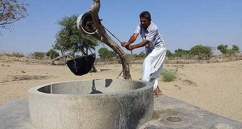
By 2030, the country’s water demand is projected to be twice the available supply, putting millions at risk of severe scarcity (NITI Aayog, 2019). Yet we lack reliable data on where, how quickly, and for whom water is vanishing. Decisions about where to farm, drill, or conserve are often based on incomplete or misleading information. For example, official numbers still label groundwater level as “safe,” even in regions where borewells have run dry, and vice versa. In our recent visit to Punjab, for a block that was groundwater “overexploited,” it had, in fact, abundant good-quality groundwater in one part (not so good in another part).
In this case, these groundwater assessments form the basis of government-level policy planning and support private investment prioritisation. A recent study by the Sattva Knowledge Institute found that Indian corporations invested an average of ₹265 crore annually in water conservation between 2016 and 2022. But in many cases, 50 to 60 percent of this was spent not on infrastructure but on collecting data to figure out where water risk lies. What is meant to be the foundation for action has become a drain on resources itself. This is more than a policy failure—poor data directly impacts lives.
India is not lacking in water data. Multiple platforms already exist, from the government-run India-WRIS to international tools like WRI’s Aqueduct and WWF’s Water Risk Filter. These provide data on water availability, rainfall trends, and flood or drought risk. But most of this is available only at the district or state level. Water systems, however, do not follow administrative boundaries. Rivers and aquifers often span multiple states and ecological zones. Planning based on mismatched scales rarely produces lasting solutions. Integration is majorly impacted by non-uniform granularity and standards, unavailable or missing datasets, and lack of interoperability.
The consequences of these gaps are already visible. In Tamil Nadu’s Kaveri delta, a2024 study in the Journal of Hydrology found that two different government agencies, the Central Ground Water Board (CGWB) and the Water Resources Department, Tamil Nadu, which was formerly the Public Works Department, reported contradictory groundwater trends for the same districts. One showed stable or rising levels, while the other marked the zone as overexploited. The likely reason was a difference in what each agency measured. In either case, official monitoring focused on shallow aquifers, while the paper notes (as have others) that deeper layers are increasingly where most farmers were drawing from. This water went unmeasured.
In the absence of reliable, local-level data, many water conservation efforts focus on short-term outputs. These include counting how many tanks were built or how many litres of water were "created," but without long-term monitoring, these structures may or may not have the intended impact. Aquifer recharge efforts struggle when the underlying geology is poorly mapped. Irrigation schemes often falter when they are not linked to real-time data on water availability or crop needs.
Even well-intentioned interventions may fail to shift outcomes on the ground. In many cases, organisations and communities find themselves returning to the same water stress they were trying to solve.
Some recent efforts suggest that more locally generated water data may address some of these issues. In 2022, the Ministry of Rural Development launched the Jaldoot Mobile App. The app allows trained village volunteers, called “Jaldoots,” to record groundwater levels in wells twice a year. The goal is to make monitoring more local, more frequent, and more participatory. These entries feed into the National Water Informatics Centre, offering a much-needed layer of village-level visibility.
In Maharashtra, the PoCRA Water Budget Dashboard, developed with IIT Bombay and the World Bank, turned to farmers to validate soil data. When official records proved outdated or mismatched, researchers asked farmers to describe the texture of the soil on their land. These inputs improved water budgeting models, which were then used to guide crop selection advisories. Through both these efforts, citizen-led data collection or citizen science is tried and tested for large-scale impact.
Meanwhile, a group of institutions, including IIT Delhi, IIT Palakkad, and WELL Labs, is collaborating onCoRE Stack, an open platform for creating high-resolution geospatial datasets at the micro-watershed level. Through tools likeIndiaSAT, the initiative has tested ways to gather crop pattern data directly from farmers. It has also worked on mapping tree canopy density using satellite imagery, reducing reliance on manual surveys.
In Karnataka and Meghalaya, the CLART mobile app, or Composite Landscape Assessment and Restoration Tool, is now being used by MGNREGA staff to support water conservation planning. Developed to be easy to use in rural contexts, the app helps identify locations for check dams, farm ponds, and recharge structures based on local geography. As of October 2024, it had supported action plans in over 1,500 Gram Panchayats.
In these cases, the shift is not just technological but also relational. Instead of relying solely on data from distant institutions, these platforms involve local actors—farmers, field workers, and communities—in building the datasets themselves. That changes what gets seen, what gets prioritised, and ultimately, what gets built.
Open data platforms such as India Observatory, SWT-India, GEMStat, and USAID’s REALWater tool already offer useful information. But if this data remains too broad or disconnected from local reality, it risks being ignored or misapplied.
Many of the most promising solutions lie in combining top-down datasets with ground-level insights. That work is already happening—in patches, through pilots, and through partnerships. What remains to be seen is how it can scale. India’s water stress is often talked about in terms of scarcity. But scarcity is only one part of the story. Without sharper, more grounded information, we may be missing the very tools we need to respond.
The article draws from a study conducted by Sattva Consulting. For the complete report, please refer to Open Data for Measuring Water Risk and the Role of Citizen Science. The views and opinions expressed in this article are those of the authors of Sattva Consulting and do not necessarily reflect the official policy or position of India Water Portal.