- Topics
- Feature
- Opportunities & Events
- About
- Hindi Portal
- Data
- Topics
- Feature
- Opportunities & Events
- About
- Hindi Portal
- Data
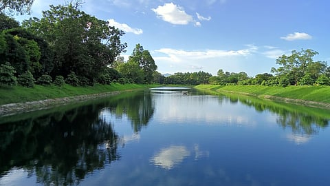
Climate stress, rapid urban growth, and governance limits could impact the Imphal basin
Mehraz Morshed; CC0 Licence

The Imphal River Basin in Manipur presents a quiet paradox. Encircled by forested hills and sustained by generous rainfall, the central valley supports nearly half a million people who rely on its rivers for everyday water needs. On the surface, the basin appears secure—wetlands still dot the landscape, and piped water connections have expanded steadily in recent years. But this apparent abundance masks a far more fragile reality.
To understand this vulnerability, the geography of Manipur matters. Just ten percent of the state is valley land; the rest consists of steep hills that channel monsoon rains into the river system. Rivers such as the Imphal, Iril, and Nambul are vital to life in the valley. Yet the monsoon that sustains them is no longer predictable. Rainfall is arriving in shorter, more intense bursts, with fewer rainy days overall and uneven seasonal patterns. These concentrated downpours trigger flash floods, worsened by deforestation and siltation in the hills, repeatedly submerging the valley. At the same time, longer dry spells before the monsoon bring water shortages, pushing urban households to depend on private tankers and rural communities on shrinking ponds. What looks like water security, in other words, is increasingly shaped by uncertainty.
When high rainfall masks uneven access and fragile systems
A new study on the Imphal River Basin offers a sobering look at what lies beneath reassuring numbers. Titled ‘Evaluation of water security status of Imphal River Basin, India: A case study based on WPI approach’, the research by Samananda Keisham and colleagues uses the Water Poverty Index (WPI) to assess the basin’s water security. Its findings point to growing systemic vulnerabilities, even in a region blessed with high rainfall and abundant surface water. Across the basin, districts show developmental gaps of 52 to 59 percent, an early warning that climate stress, rapid urban growth, and governance limits could overwhelm existing systems.
The study focuses on four districts, Imphal East, Imphal West, Thoubal, and Kangpokpi, and evaluates them across five dimensions: water resources, access, capacity, use, and environmental conditions. While all four districts fall within the WPI’s “good” range, with scores between 0.41 and 0.48, the researchers caution against taking this at face value. These averages conceal sharp internal differences and rising risks. Much of the basin’s current water security depends on fragile wetlands, uncertain rainfall, and uneven infrastructure—factors that are increasingly exposed as climate change intensifies.
Measuring water scarcity beyond supply
Seen through the Water Poverty Index, water scarcity in the Imphal River Basin is not just about how much water is available. It is also about who can access it, who can manage it, and how secure those systems really are. The study draws on district level data from economic surveys, statistical yearbooks, the National Wetland Atlas, and the Manipur State Action Plan on Climate Change. It looks at a wide set of indicators, including rainfall and its variability, wetland area, access to tap water and sewerage, irrigated land, literacy, economic activity, domestic water demand, fertiliser use, and forest cover. Each component is given equal weight to create a composite index that ranks districts and shows which factors shape water poverty most strongly.
This approach reveals sharp contrasts within the basin. In terms of water resources, Thoubal stands out with a strong score of 0.67, driven by large wetlands such as Kharung Ikop and Pumlen Khoidum that together span more than 130 square kilometres and help store water during dry periods. Imphal East and Imphal West, by contrast, score poorly because urban expansion has eroded wetlands like Lamphel and Heingang. As these natural buffers disappear, so do traditional ponds that once supported neighbourhood water needs.
Infrastructure helps but capacity still matters
Access to water presents a more hopeful picture, at least on paper. Imphal East and Imphal West benefit from expanded piped water networks, and Imphal now hosts the state’s first sewage treatment plant. By 2024 to 25, tap connections covered 77 percent of households in Imphal West, 80 percent in Imphal East, and nearly 89 percent in Thoubal. Even Kangpokpi, with lower urbanisation, reports coverage of about 86 percent. Yet the study cautions that pipes do not always mean water. During pre monsoon months, supplies often fail, showing that infrastructure cannot compensate for weak or stressed water sources.
The capacity to manage water varies just as sharply. Imphal West performs best, supported by higher literacy and a more diverse economy. The study finds that literacy plays a key role, as informed households are more likely to demand safe water, conserve it, and engage with public schemes. Thoubal, despite its rich wetlands, scores low on capacity, highlighting a central finding of the research. Natural abundance alone cannot protect communities when livelihoods depend heavily on climate sensitive agriculture and social and economic support systems remain fragile.
Water use and environmental stress
Patterns of water use show how closely supply is tied to both population pressure and infrastructure. Kangpokpi performs best on this measure, mainly because fewer people place lower demands on available water. Thoubal and Imphal West also fare reasonably well. Imphal East, however, falls behind due to weak irrigation systems and heavy dependence on rain fed farming. The study points out that nearly half of Thoubal’s cropped land is irrigated through canal networks, which helps farmers cope during dry spells. Other districts lack such systems, leaving them far more exposed to changing monsoon patterns and the risk of crop failure.
Environmental conditions deepen these vulnerabilities. This component looks at fertiliser use, runoff from farms, forest cover, and the overall health of rivers and wetlands. Imphal West records the weakest performance, driven by intense urban growth that has broken up natural water systems. Pollution in the Imphal, Nambul, and Kongba rivers from untreated sewage, waste dumping, and farm chemicals has severely degraded water quality. The study warns that climate extremes could worsen these pressures. Ongoing deforestation in Kangpokpi and nearby hill areas further reduces the basin’s ability to absorb floods and store water, as erosion and sedimentation continue to rise.
Fig.(a) Elevation, and (b) LULC pattern of the Imphal river basin.
Samananda Keisham et al.
While each district reveals different strengths and weaknesses, the overall WPI scores show only marginal differences: Kangpokpi ranks first (0.48), followed by Thoubal (0.46), Imphal West (0.42), and Imphal East (0.41). This similarity might suggest a uniformly stable basin, but the developmental gaps tell a very different story. Even the highest-scoring district has a 52% gap from the ideal water security threshold, while Imphal East, the most vulnerable, has a 59% gap. These values indicate that half of the basin’s water security potential remains unrealised, leaving communities exposed to climate shocks and systemic failures.
Key interpretation
The key performance points for the different districts in terms of water security:
Kangpokpi: Leads in overall water security, driven by strong performance in use and capacity.
Thoubal: Excels in resources (specifically wetlands and rainfall) but suffers from a weak capacity score.
Imphal West: Shows strong performance in access and capacity, but is noted as being environmentally weak.
Imphal East: Maintains relatively good infrastructure access but has the lowest use component due to high population pressure and limited irrigation.
One of the most important findings of the study is the relative influence of different components on the overall WPI. Access emerges as the most influential driver, followed closely by environment and use. Capacity and resources have comparatively lower influence. This diverges from studies in other parts of India where natural resource availability typically plays a dominant role. In the Imphal basin, however, piped supply, sanitation, and irrigation infrastructure shape water security far more than rainfall or wetland extent. This reflects the urbanising nature of the basin, where households increasingly depend on centralised infrastructure rather than traditional water bodies. Yet it also highlights a structural risk: heavy reliance on built systems means that any failure—whether due to drought, contamination, or infrastructure breakdown—could have cascading effects across communities.
The study’s conclusions carry significant implications for policy and planning. The authors argue that improving accessibility and strengthening community capacity should be priority areas for climate adaptation in the basin. This includes investing in piped water reliability, expanding sewerage coverage, revitalising wetlands, and restoring community ponds as decentralised storage systems. The study underscores the need for basin-level water audits to quantify demand–supply gaps, along with participatory water conservation initiatives that involve local communities, water user groups, and municipal councils. Strengthening livelihoods, providing credit and insurance, and promoting alternative economic activities are also essential to reduce the socio-economic vulnerabilities that amplify water insecurity.
Environmental management emerges as another core imperative. Reversing wetland degradation, regulating agricultural runoff, and curbing deforestation in the hills are critical not only for ecological restoration but for maintaining the basin’s hydrological balance. Without these interventions, urban infrastructure alone cannot shield communities from climate-driven extremes.
The Imphal River Basin stands at a crossroads. Its current WPI classification of “good” may suggest stability, but the underlying gaps reveal a basin in transition—one where climatic variability, demographic pressures, and ecological degradation intersect with limited institutional capacity. The study offers a clear message: water security in Imphal is no longer about ensuring supply during dry months; it is about rethinking how water, ecosystems, and livelihoods are governed in a rapidly changing landscape. Future resilience will depend not just on more infrastructure, but on restoring the ecological foundations of the basin, strengthening local capacities, and integrating water security planning with climate adaptation. The findings provide a critical blueprint for policymakers, offering evidence-based insights that are essential for safeguarding the basin’s water future.