
- Topics
- Feature
- Opportunities & Events
- About
- Hindi Portal
- Data
- Topics
- Feature
- Opportunities & Events
- About
- Hindi Portal
- Data
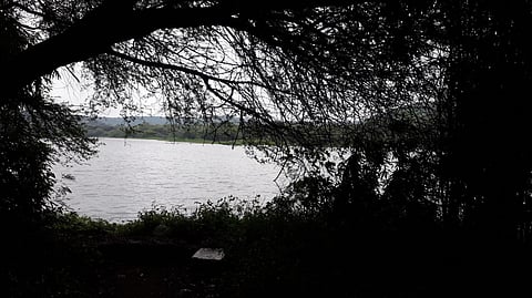
The Pashan lake in Pune. Image Source: Nikhil12sutar via Wikimedia Commons

Surface water bodies (SWBs) such as lakes, ponds, and reservoirs are valuable freshwater resources providing water for drinking, agriculture, and industrial use while supporting biodiversity and aquatic ecosystems and maintaining the ecological sustainability of the surrounding environment. They also play a crucial role in the hydrological cycle by acting as buffers, regulating surface runoff, and aiding in storage and distribution of water.
India has a vast number of SWBs distributed across different climatic zones. They are categorised into small (0.1–1 km2), medium (1–10 km2), and large (>10 km2) and are becoming increasingly vulnerable to climate extremes, particularly droughts, disrupting the balance between inflows and outflows. However, very little information is available on the impact of droughts on SWBs in India.
This open access study titled ‘Drought-driven shrinkage of surface water bodies in India ‘ by M Niranjannaik and Vimal Mishra, published in iScience aims at exploring the impacts of droughts and their severity on shrinkage patterns of SWBs across different climatic zones in India. The study examines Lansat satellite-derived area data on 10,476 SWBs during 1990–2017 to understand their shrinkage patterns.
The climate zones examined in the study include:
The Tropical wet zone, or the tropical monsoon/humid climate zone that includes the Western Coastal Plains & Western Ghats, the Northeastern States and the island territories of Lakshadweep and Andaman and Nicobar islands.
The tropical wet and dry regions include Central India, mainly inland areas of Maharashtra, Madhya Pradesh, and Chhattisgarh; Eastern States such as parts of Odisha, West Bengal, and southern Assam; and the Southern Interior, which includes the majority of the interior Deccan Plateau, excluding the coastal strips and the rain-shadow semi-arid zones
Arid zones include major parts of Rajasthan, Gujarat, southern parts of Punjab and Haryana and a small portion of the Deccan Peninsula in the states of Andhra Pradesh, Karnataka and Maharashtra
Semiarid zones include the states of Punjab, Haryana, Rajasthan, Uttar Pradesh, Madhya Pradesh, Gujarat, Maharashtra, Karnataka, Andhra Pradesh and Tamil Nadu
Humid subtropical zones include parts of northern and eastern India, including the Gangetic plains
Mountain frost: Trans Himalayas and the cold deserts.
The spatial distribution of surface water bodies in India
Image Source: Niranjannaik & Mishra (2026), Drought driven shrinkage of surface water bodies in India. iScience 29, 116737, p 2.
A preliminary look at the shrinking patterns indicates that nearly half (44.5%) of the SWBs have shrunk in area, while 29.4% of the SWBs show a significant increase in surface area. The long-term trends show a pronounced decline in several subbasins across the north and south Indian regions. Approximately 80% of SWBs in the Ghaggar subbasin within the semi-arid zone exhibit a significant decreasing trend. Widespread declines are also seen in the Ganga Basin, where 60%–80% of SWBs show significant reductions in the Gandak, Sone, upper Gomti, and upper Yamuna subbasins under a humid subtropical climate. Additionally, 40%–60% of SWBs in the Krishna, Pennar, and Kaveri subbasins of the semi-arid zone display significant decreasing trends.
In contrast, more than 80% of SWBs in the Mountain Frost climate zone exhibit a significantly increasing trend due to glacial melting as a result of rising temperatures. More than 40% of SWBs in the westward-flowing lower Narmada and Bhadar subbasins show an increasing trend. Moderate increase (40%–60%) in surface area in SWBs is seen in the west-flowing river subbasins such as the Narmada, Sabarmati, Mahi, Luni, and Shetranjali, as well as the east-flowing lower Godavari sub-basin, which is predominantly located in semi-arid climate zones. These increases can be attributed to an increase in rainfall over the region.
What happens during dry and wet years
Image Source: Niranjannaik & Mishra (2026), Drought driven shrinkage of surface water bodies in India. iScience 29, 116737, p 2.
During wet years, the majority of SWBs (80%) show an expansion of water area, with SWBs in the tropical wet and dry and semi-arid climate zones showing pronounced water gain during wet years. In contrast, 67% of SWBs in the Mountain Frost climate zone show shrinkage in water area by around 15.7 km2 despite an increase in rainfall. This could be due to a decline in mean annual temperature that freezes the SWBs, causing shrinkage in the surface area in the Mountain Frost region.
During dry years, most SWBs (82%) show shrinkage in surface area across all climate zones, except for the Mountain Frost climate zone, where the majority of SWBs show expansion. The SWBs in semi-arid climate zones experience the most pronounced shrinkage (20%), reflecting their strong dependence on rainfall. In contrast, the expansion of SWB in the Mountain Frost climate zone is due to warmer temperatures, which melt the glaciers and snow, resulting in an increase in water availability.
Summer monsoon
The summer-monsoon season is the most important source and a critical period that helps in filling up surface water bodies, thus expanding their surface area. During the dry summer monsoons, the majority of the SWBs in the semi-arid, humid subtropical, and tropical wet and dry climate zones of central India exhibit high shrinkage (>10%). However, SWBs in the Mountain Frost and Arid climate zones are the least affected. A dry monsoon alone causes a 5% decline in the mean SWB area in India. Winter droughts lead to a 2.5% shrinkage in the semi-arid and tropical wet and dry climate zones of the central Indian region.
Dry summers and winters
Successive dry seasons within a single water year result in the highest water loss. The SWBs experiencing consecutive dry summer-monsoon and winter seasons of the water cycle show an 8.5% water area shrinkage – nearly three times greater shrinkage than that affected by a single summer-monsoon dry season.
Dry winters and premonsoon
Dry winter and pre-monsoon seasons lead to a decline of 2.7% and 0.65%, respectively.
The dry monsoon season has the greatest impact, even when other seasons are wet, resulting in a 1.33% reduction in surface area. During dry seasons and years, the highest shrinkage in surface water area is observed in the semi-arid, humid subtropical, and tropical wet and dry climate zones driven by high water demand, limited winter rainfall, and rapid depletion of surface water reserves. In contrast, the SWBs in the Mountain Frost climate zone show an expansion of water area driven by snowmelt due to warming.
The impact of drought is most evident during the summer-monsoon and winter seasons, and successive dry conditions in these seasons increase water loss by three times compared to individual seasons.
As droughts get worse, larger lakes and reservoirs shrink more than smaller ones, except in the Mountain Frost zones, where the SWB area is found to expand as drought severity increases.
Arid & semi-arid SWBs are the most vulnerable, where medium and large SWBs lose >13% area under extreme drought. In tropical wet & humid subtropical zones, all sizes shrink, with large SWBs losing up to 10%, as high population and farming make the stress worse. In tropical wet & dry zones, large, shallow SWBs decline sharply because they depend on rainfall. With Mountain Frost in the Himalayas, small SWBs expand during moderate drought due to glacier melt. But under severe drought, medium and large SWBs also shrink.
Thus, small SWBs are more resilient and withstand the impacts of severe droughts, except in glacier-fed zones where they can even expand. In contrast, large SWBs are the most exposed and suffer the biggest losses in surface area. Arid/semi-arid zones are the hardest hit overall.
The spatial distribution of SWBs by shrinkage rate.
Image Source: Niranjannaik & Mishra (2026) Drought driven shrinkage of surface water bodies in India. iScience 29, 116737, p 8.
Small SWBs show the highest shrinkage rate due to limited storage and fast response to drought, while medium SWBs show moderate shrinkage. Large SWBs show the lowest shrinkage rates. Thus, small SWBs shrink the fastest in all the zones. However, mountain frost zones (Himalayas) show a different behaviour, with small SWBs showing less shrinkage than medium/large ones, and sometimes even expanding during dry years due to glacier and snowmelt.
The impact of increasing drought intensity on the SWB area accelerates shrinkage among all SWB sizes in India. However, large SWBs exhibit the highest decline in water area as the drought severity increases, likely due to a decline in runoff and an increase in evaporation. In contrast, small SWBs shrink faster relative to their size, which might be due to shallow depth and limited inflow, making them more vulnerable to short-term climate stress.
The spatial variability in the SWB area is also affected by land-use and cover (LULC) changes and regional climatic contrasts. For example, in the Ganga plains, cropland expansion combined with declining rainfall and rising temperatures has resulted in a substantial reduction of the SWB area exceeding 60%. In addition, intensive groundwater extraction for irrigation has significantly depleted groundwater storage in the region. Similarly, SWBs in the South Indian sub-basins (Godavari, Krishna, Cauvery, and Penna) have also experienced major declines (40%–60%), despite increasing precipitation and relatively stable temperatures due to cropland expansion, increasing impervious surfaces, and unsustainable water management. In contrast, in the Mountain Frost climate zones, more than 80% of the SWBs show an increasing trend, primarily influenced by glacier and snow cover loss. The snow cover loss is driven by a significant increase in temperature and declining rainfall.
More than 40% of SWBs in the western-flowing (i.e., Narmada, Mahi, and Sabarmati) and eastern-flowing Mahanadi Basins show a significant increasing trend, despite rising temperatures, driven by increased rainfall. Declining water areas are closely associated with increasing temperatures and reduced rainfall, and excessive use of surface water and groundwater extraction for irrigation during drought periods further exacerbates long-term stress on SWBs.
Addressing the water area changes, shrinkage rate, and shrinkage duration under increasing drought intensities can provide valuable information on the vulnerability of SWBs and help in developing drought preparedness and water scarcity mitigation strategies, enabling policymakers and local stakeholders to implement actions on time. The high sensitivity of SWBs to droughts, particularly in arid, semi-arid, humid subtropical, and tropical wet and dry regions, has important implications for water policy and drought management.
The results show that:
The drought impact on small, medium, and large SWBs reveals that small SWBs require more attention due to their rapid depletion, while large SWBs need basin-scale coordination to reduce the losses during prolonged droughts.
Groundwater governance plays a crucial role in maintaining SWBs, as excessive pumping can transform SWBs from recharge zones into groundwater sinks and vice versa, worsening the impacts of droughts. Integrated surface- and groundwater management policies are therefore essential for sustaining both surface and subsurface water resources during droughts.
Protecting SWBs from encroachment is important to preserve natural drainage pathways, and restricting land-use change within optimal catchment buffer zones improves rainfall capture, slows down water loss during droughts, and sustains storage. In river-connected systems, maintaining minimum environmental flows can further prolong downstream SWB persistence during droughts.
The results show that identifying SWBs affected by droughts in the semi-arid regions of central and south India and the tropical sub-humid region of the Ganga plains can greatly help restore and conserve water resources in areas with high recharge potential.
Conserving SWBs over highly permeable or unconfined aquifers within the tropical sub-humid climate zone can substantially enhance natural groundwater infiltration. Additionally, the basaltic aquifers in the semi-arid region of central India, particularly in the Deccan basalt region, can be more suitable for localised groundwater recharge that can help sustain baseflows during dry periods.
Incorporating lake dynamics into long-term, basin-scale hydrological planning, including lake interlinking, rainwater harvesting, and multisource water budgeting, can go a long way in sustaining SWBs in the country.