- Topics
- Feature
- Opportunities & Events
- About
- Hindi Portal
- Data
- Topics
- Feature
- Opportunities & Events
- About
- Hindi Portal
- Data
Unprecedented expansion and anthropic activities amongst other reasons lead to choking of urban rivers with municipal and industrial sewage. Around 63% of the total 62 million litres/ day generated sewage is dumped in Indian urban rivers without treatment, as per a Central Pollution Control Board report submitted to National Green Tribunal, India.
Urban rivers are dying while awaiting rescue, despite the hard efforts by civic authorities, largely due to lack of coordination amongst river authorities and stakeholders, underlying conflicts spanning across all levels, balkanisation, pluralization, scarcity of reliable technical data, and financial constraints.
Implementation of river pollution policies faces weak enforcement gap due to several challenges associated with urban rivers.
A recent study identifies the challenges associated with environmental monitoring over urban industrial catchments. The paper ‘River pollution monitoring over an industrial catchment in urban ecosystem: Challenges and proposed geospatial framework’ in the journal Environmental Challenges presents a geospatial framework which if functionally implemented can transparentize river water quality (WQ) monitoring, and facilitate pollution control.
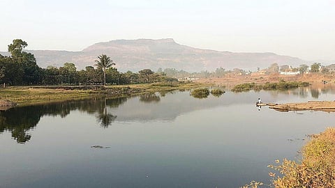
The pollution situation in a persistently polluted urban river near Mumbai city, India was explored and assessed in the middle of a restoration battle waged by environmental activists.
For systematic inventorisation of secondary data including river water quality data, informational interviews were conducted with the concerned stakeholders – state pollution control agency, STPs/ CETPs and industrial development corporations pertaining to the study area, and urban local bodies operating in the study area.
Thorough analysis of the available secondary data was done and a corroborative comprehensive summertime (just before monsoon when river water quality is worst) monitoring in the study area was also performed despite facing several practical problems.
Following secondary river water quality data acquisition, primary sample collection campaign and water quality testing, multivariate statistical data analysis was performed under data- and resource-constraint situation.
Spatiotemporal monitoring and visualization of river water quality data holds great promise for effectively controlling anthropic river pollution. A subsequent geospatial analysis of the study area was performed using digital elevation model (DEM) based watershed delineation, land use land cover (LULC) classification, mapping of water quality monitoring locations, mapping of industrial clusters, integration of spatial data, and identifying polluter industries.
This steered the authors to formulate and propose the geospatial framework and supplementary recommendations on how better to save this dying river.
The study area physically explored for pollution assessment is the Ulhas-Waldhuni watershed located in the intensely urbanized Mumbai Metropolitan Region. The physical exploration of the pollution situation in the study area revealed its river stretches to be intensely polluted.
In the current study, multivariate statistical analysis techniques were applied to rationalise water quality parameters and monitoring locations on two sets of reliably consistent secondary datasets from 5 locations procured from Monitoring of Indian National Aquatic Resources System (MINARS) project under National Water Quality Monitoring Program (NWMP).
In an effort to help manage their overwhelm and transparentize pollution monitoring processes and in extension facilitate anthropic river pollution control, the use of the proposed geospatial framework is demonstrated for spatiotemporal pollution monitoring that is tech-friendly and can facilitate collaborative management of pollution issues in any urban river system.
This paper discusses the benefits of multivariate statistical analysis on water quality data and of integrating GIS in pollution monitoring through application of remote sensing technology, spatial analysis and role of IoT for near real-time information on water quality status quo at impaired river stretches, particularly in urban industrial ecosystem.
Moreover, the unbiased data acquisition capabilities of remote sensing technology and integration with field information in GIS platform will enable policymakers to visualize the ground situation and take timely decision toward better planning and management of river over industrial catchment in urbanized ecosystem.
The GIS based monitoring, if functionally implemented, shall enable the extraction of near real-time river water quality status information at any point in the river stretch, which shall help track the impaired river stretches. This can assist in transparent source apportionment analyses.
This is not a policy tool but a planning tool to facilitate GIS-based decision-making, particularly for the ground technical staff. The proposed framework is appropriate for decision support for pollution control agencies in study areas with data and resource constraints. Urban river stakeholders in other similar areas will be able to relate to the challenges recognized in the current study.
Applying the proposed geospatial framework, that is capable of incorporating numerous water quality parameters and sampling locations, would facilitate collating river water quality data consistently and unbiasedly. The proposed GIS tool may be coupled with optimization models to maintain and predict river water quality in future.
With the availability of spatial data and advanced GIS tools in open-source domain (e.g., QGIS), the proposed geospatial framework can be replicated for any urban river ecosystem with no cost.
The framework displays near real-time information on river water quality at different impaired river stretches in urban industrial ecosystem, thus stimulating timely action for pollution control. Applicable universally for monitoring any river in urban industrial catchment, it can be used as a reference by stakeholders and research aspirants.
It is a given that condition of rivers in highly urbanized areas, with increasing population density and disproportionate infrastructural expansion is deteriorating. This paper demonstrates the possibility and advantages of a GIS-based near real-time water quality monitoring of rivers flowing through urbanized industrial catchments consisting of heavy built-up areas, which will also prevent illegal wastewater dumping/accidental spills with use of sensor-based systems.
However, need of the hour are consistent and reliable river water quality data for robust visualization and analysis. Unless aligned efforts from river stakeholders and use of geospatial technology are made part of the solution, urban rivers will keep struggling to stay alive. The proposed geospatial framework and recommendations derived during execution of this study are universally applicable to any river and have been presented as an effort in this direction to facilitate effective pollution mitigation of urban rivers.
The full paper can be accessed here