


These images from the UNOSAT site, are an example of flood detection based on satellite maps of the affected state of Bihar, both in 2007 and 2008. These maps are based on preliminary analysis and not validated in the field.
Click here for image of flood affected areas of Bihar on 23rd August 2007
Click here for image of Chhatarpur town in Supaul district taken on 24th August 2008
Click here for image of flood affected areas of Bihar on 31st August 2008
Posted by
Attachment
 UNOSAT_IND_Bihar_Floods_IRS_Chhatapur_24Aug08_Highres.pdf
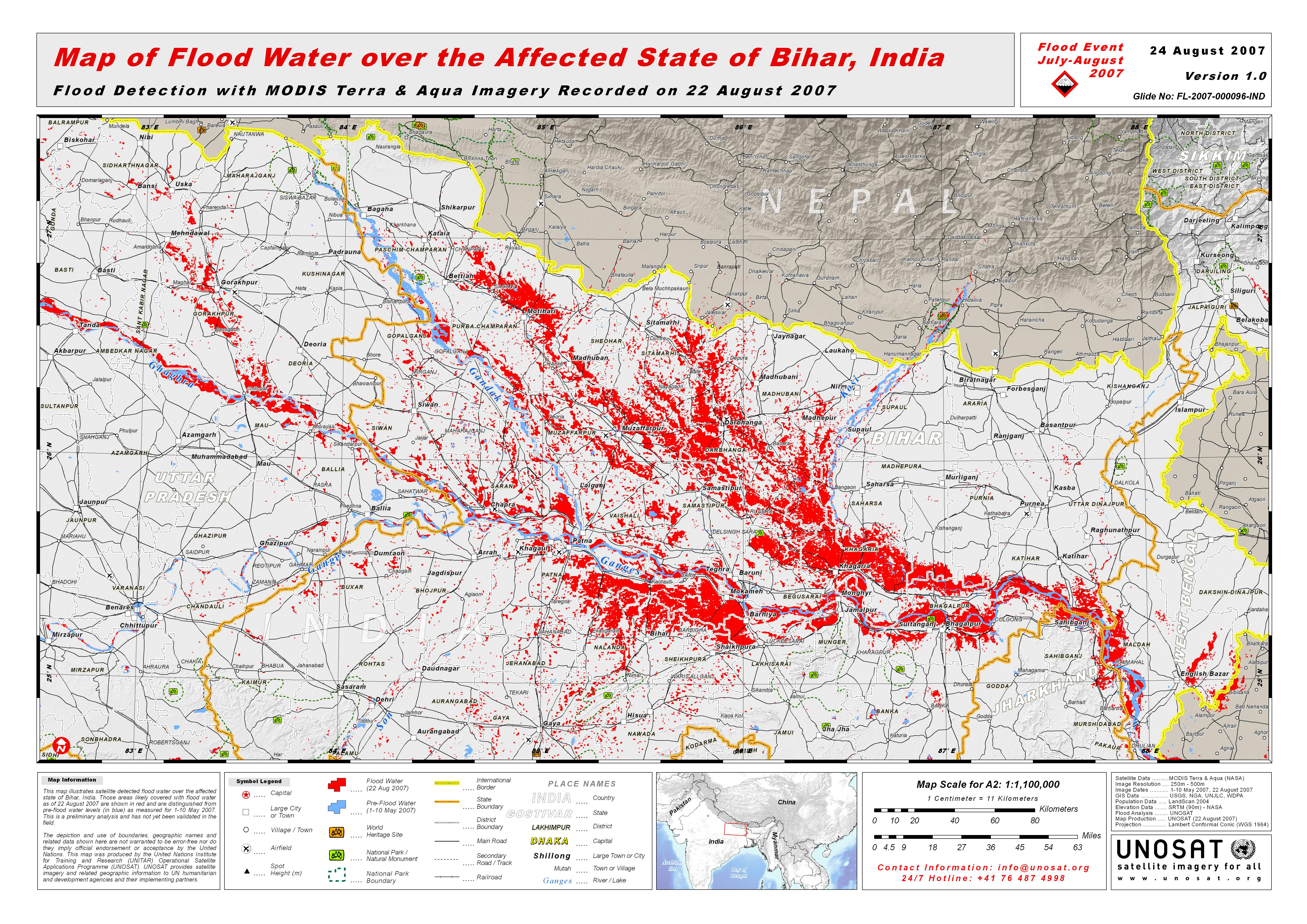 UNOSAT_India_Bihar_Flood_Map_23Aug2007_Highres_v.jpeg


