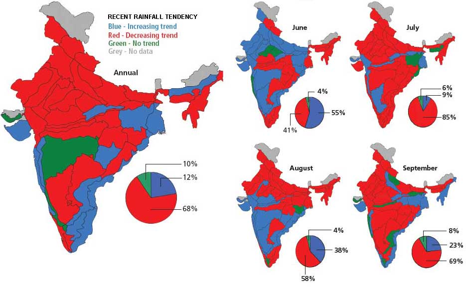
The map shows that there is a decreasing trend of rainfall over most of peninsular India (barring Maharashtra) including the western part of the Gangetic plain and the north eastern states apart from Assam.
An increasing trend of rainfall has been observed for the eastern part of the Gangetic plain, Assam, Telengana and all coastal regions of the country.

For more information, log onto the Indian Institute of Tropical Meteorology's website
Posted by
Attachment


