- Topics
- Feature
- Opportunities & Events
- About
- Hindi Portal
- Data
- Topics
- Feature
- Opportunities & Events
- About
- Hindi Portal
- Data
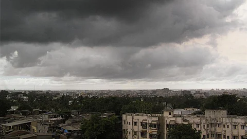
La Niña is set to make a comeback for the second consecutive year, keeping meteorologists busy across the world. La Niña is defined as an oceanic-atmospheric phenomenon, El Niño-Southern Oscillation (ENSO), wherein water temperatures in the Equatorial Pacific Ocean become cooler than normal because of the upwelling of cold water from the bottom of the sea.
Meanwhile, the warming phase of the Pacific water is termed El Niño. La Niña has the capacity to alter the direction as well as the velocity of the trade winds, which trigger the winter season in India.
According to meteorologists, La Niña has an association with winter rains over North India. Unlike El Niño, it may not have a strong correlation with the seasonal features but remains consequential for the seasonal performance. Though there is no rule book for La Niña’s behavioural patterns, the performance for winter rains is expected on the following lines:
A lot has been already written about this global oceanic phenomenon which tends to trigger extreme weather conditions. However, scientists and meteorologists are now mulling over how climate change and the rise in global temperatures are impacting the usual patterns of La Niña.
Sea surface temperatures (SST) variability and extreme ENSO events are projected to increase under greenhouse warming. According to a research paper, while the possibility of large changes in ENSO cannot be ruled out, research conducted to date does not yet precisely say what changes could occur.
However, global warming impact may lead to changes in the characteristic amplitude or frequency of ENSO events. If global temperatures continue to rise unchecked, the climate of the Pacific is likely to undergo significant changes. The trade winds will weaken, the pattern of SSTs will change that is likely to be zonally-symmetric with maximum warming on the equator and the thermocline is likely to flatten and become shallow. A thermocline is the transition layer between the warmer mixed water at the surface of the ocean and the cooler deep water below.
According to a report by Nature, global warming has increased the frequency of extreme El Niño that provides a favourable condition for extreme La Niña. This occurs amidst faster warming over the Maritime continent region (the region between the Indian and Pacific Oceans) than the central equatorial Pacific and increasing vertical temperature gradients that are conducive to extreme La Niña events.
The overall increased frequency in extreme La Niña events, most of which occur after an extreme El Niño, has important implications. It means more occurrences of devastating weather events, and more frequent swings of opposite extremes from one year to the next, with profound socio-economic consequences.
Climate change is expected to further amplify the cold (La Niña) and warm (El Niño) phases of ENSO, respectively. India is already battling with a substantial increase in extreme weather events, erratic Monsoon patterns and much stronger cyclonic storms.
The usual traits of La Niña include reduced snowfall and winter rains across Northwest India, which scientists believe would enhance stress on the Himalayas that are already dealing with rising temperatures.
“We know that warming is not going to reduce and whenever there would be poor rainfall during the winter season, it would increase the stress on Himalayan ecology. There would be enhanced climate effects on the vegetation. The situation would be quite troublesome be it for agro-forestry, vegetation or fruit production, etc. There is also a probability of glaciers retreating but at what rate is uncertain,” said Dr Jagdish Krishnaswamy, Dean, School of Environment and Sustainability, Indian Institute of Human Settlements.
Argha Banerjee, Glaciologist, Earth and Climate Science, Indian Institute of Science Education and Research-Pune added, “Majority of snow over the glaciers is brought by the Monsoon season. Winter snowfall is very important as it provides snow cover to the glacial ice. Snow is the only source for nourishing the glaciers. It has been established that because of higher temperatures due to climate change and global warming, we see more rain than snow. If there is less snowfall, there will be less accumulation of snow over the glaciers. Also, in the absence of precipitation, the spring melting season is also likely to begin early. Glaciers would be exposed to solar radiation quite early in the season, which tends to melt at a much faster rate on account of already high temperatures. And, this melting season would also be a prolonged one.”
According to experts and scientists, the Himalayas are ecologically very fragile and with anthropogenic (human-led) factors, the region is quite vulnerable to natural disasters like flash floods, landslides and torrential rains. Like the one, we saw in Chamoli district in Uttarakhand in February 2020.
According to research by NOAA, extreme El Niño and La Niña events may increase in frequency from about one every 20 years to one every 10 years by the end of the 21st century under aggressive greenhouse gas emission scenarios.
Michael McPhaden, a senior scientist with NOAA’s Pacific Marine Environmental Laboratory said in the report that the strongest events may become even stronger than they are at present. Less clear is the potential evolution of rainfall patterns in the mid-latitudes, but extremes may be more pronounced if strong El Niños and La Niñas increase in frequency and amplitude.
Winters made an early arrival in November this year, courtesy of widespread snow and rainfall across Northwest India. Since then, as predicted, snowfall, as well as winter rains, have remained missing in action. According to a report by Bloomberg, temperatures in India are expected to fall to as low as 3 degrees Celsius (37 Fahrenheit) in some northern areas in January and February before recovering as La Niña is likely to peak during that time.
Northwest India is now gearing up for a prolonged winter season ahead, along with some record low temperatures across the Indo-Gangetic plains.
“What brings cold to the region, is the unabated north-westerly winds which bring chilly winds from higher latitude to Indo-Gangetic plains. However, the passage of back-to-back western disturbances tends to change the wind direction from cold north-westerlies to warm and humid easterlies. However, with La Niña in place, we expect less amount of winter rains and thus, icy cold winds would continue to blow over Northwest India uninterruptedly, bringing down the temperatures,” said G P Sharma, President- Meteorology and Climate Change, Skymet Weather.
As we enter into the thick of the winter season, we would see a series of cold waves engulfing both the hilly as well as plains of Northwest India. Akin to La Nina season characteristics, minimum temperatures have already started plunging into the lower single digit, much below their average normal temperature. Meteorologists have predicted minimum temperatures are likely to close to the freezing point in the coming days.
The cold wave is declared when the minimum temperature across the plains settles below 10°C and is 4-6 degrees below the normal average temperature. Meanwhile, the criteria for hills is 0°C.
According to a study published by the International Journal of Climatology, within a phase of warm equatorial SST (El Niño), enhanced wintertime precipitation over Northwest India is observed and vice versa (La Niña). During the warm (cold) phase of ENSO, Western Disturbances intensify due to the lowering of geopotential height and strong north-easterly flow. Large scale Sea Surface Temperatures (SST) forcing suggest that warm equatorial Pacific is linked with higher amounts of wintertime precipitation over Northwest India.
“La Niña strengthens the south-westerly jet, which is responsible for bringing the Winter season over North India. It would translate into intermittent waves of extremely cold weather throughout the season. Also, the cyclonic circulations would be more marked and would have the probability to penetrate deeper into Northwest India. With this, we can expect a series of intense cold waves, record low temperatures and chilly winds,” said Professor A P Dimri, School of Environmental Science, Jawaharlal Nehru University.
Raghu Murtugudde, Professor of Atmospheric & Oceanic Science and Earth System Science at the University of Maryland, currently Visiting Professor at IIT Bombay said, “La Niña has the potential to affect India’s winter as it influences the wind pattern and speed. During the winter season, we see north-easterly winds near the land surface, accompanied by a so-called Southwesterly Jet in the upper atmosphere. While El Niño pushes the jet southward, allowing more western disturbances to bring rain and snow into north-western India. However, La Niña produces a more north-south low-pressure system.”
“La Niña brings cold air from Siberia and South China over the Indian subcontinent that interacts with the tropical heating to produce a north-south low-pressure system. The cold air associated with this north-south trough tends to extend much further south into India. This is remarkably different from the more northwest-southeast blast of cold air associated with an El Niño. In general, the La Niña cold air thus occupies a much larger portion of India than the El Niño cold air,” added Raghu.
As expected, La Nina tends to drive rains during the second half of the Northeast Monsoon that spans from October to December. Similar was the case this season as the Southern Peninsular region has recorded some heavy to very heavy rains, especially in Tamil Nadu and Coastal Andhra Pradesh. As per the data, South Peninsular region has recorded cumulative rainfall of 441.7 mm against the normal of 265.9 mm, making it an excess of 66% as of December 15.
According to NOAA, La Niña conditions are finally present over the Pacific Ocean. Equatorial sea surface temperatures (SSTs) are below average across the central and east-central Pacific Ocean, along with the deepening of the thermocline layer.
La Niña is declared when the Oceanic Niño Index (ONI) value is lower than or equal to -0.5°C for overlapping 3 months for five consecutive episodes. ONI is the measuring criteria for ENSO, which is the three months running mean of SST anomaly in the Niño 3.4 region of the Pacific Ocean. The most recent ONI value, SON (September – November) is -0.8°C (refer to the table below). The next episode is most likely to follow the same path, indicating towards La Niña.
Going by the latest reading of weather models by NOAA, the probability of La Niña conditions is 95% in December 2021-February 2022. Thereafter, these conditions will decline but will remain as high as 60% during the late spring season.
This will be the second winter in a row with La Niña. Last year, La Niña developed in August and dissipated in April 2021. North India in winter 2020-21 had a particularly harsh winter and a lot of winter precipitation such as freezing rain, snow or sleet.
