


The NRSA and the Govt of India is working together to provide near real time data on the current flood situation in Bihar by using satellite imagery.
The following image is from the NRSA website: 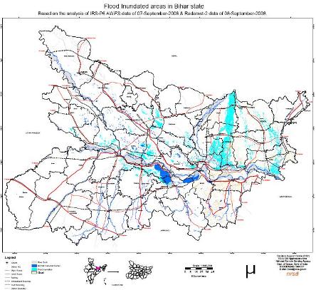
The following points are noted in the accompanying documentation. - Satellite data fully covers Bihar state. - Major flood inundation was observed in Supaul, Madhepura, Saharsa, Samastipur and Katihar districts. - The inundation due to breach in Kosi is clearly seen in satellite data. Access the original high-resolution pdf & image analysis reports here: Read More
Posted by
Attachment


